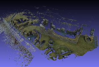
- Import Photosynth data
- Compute normals for point sets [Number of neigbors: 20]
- Surface Reconstrution: Poisson [Octree Depth: 14]
- Subdivision Surfaces: LS3 Loop [Iterations: 3]
- Subdivision Surfaces: Catmull-Clark
- Vertex Attribute Transfer: [From point set: Color, Normal, Geometry]
- Remove Duplicate Vertex
- Select Faces with edges longer than... [Edge Threshold: 0.05]
The results look something like this:

To combine two or more distinct overlapping meshes I use Meshlab's Iterative Closest Point alignment tool to find a best fit:

Once the meshes are combined the above process can be repeated to create one seamless mesh like so:

Now to repeat this process for each of the sections to try and achieve even coverage across the site. A long way still to go...


No comments:
Post a Comment